Location: Richmond, VA | Client: City of Richmond and Green Infrastructure Center | Project Date: November 2009 – December 2010
Project Images


Links and Resources
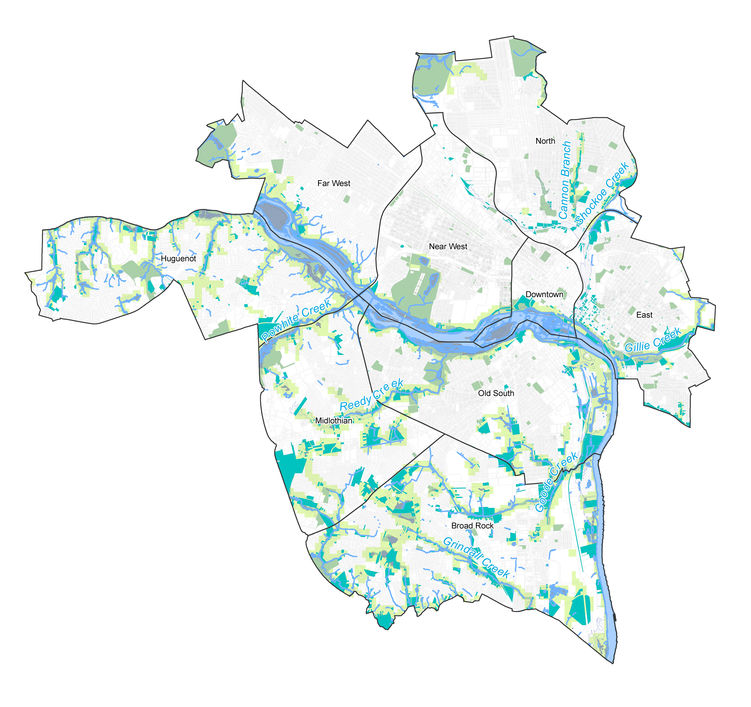
Richmond Green Infrastructure Assessment
Conservation Corridor Planning Report
Project Description
Situation
Like many historic, post-industrial cities, Richmond, Virginia contains neighborhoods that suffer disproportionately from cumulative vacant and potentially contaminated properties. These underserved neighborhoods also lack access to the rich recreational amenities of Richmond, including the scenic James River and associated trail system. Meanwhile, much of the Richmond region’s natural assets are being impacted by suburbanizing development patterns.
Solution
The Green Infrastructure Center (GIC) contracted Skeo Solutions to develop the first green infrastructure assessment of vacant lands for the City of Richmond. Skeo Solutions assembled a team of local and regional partners, including representatives from across key city departments, to identify project goals and guide the assessment process. As part of the assessment, Skeo Solutions:
- Created a vacant lands inventory to capture all known vacant parcels in a comprehensive dataset.
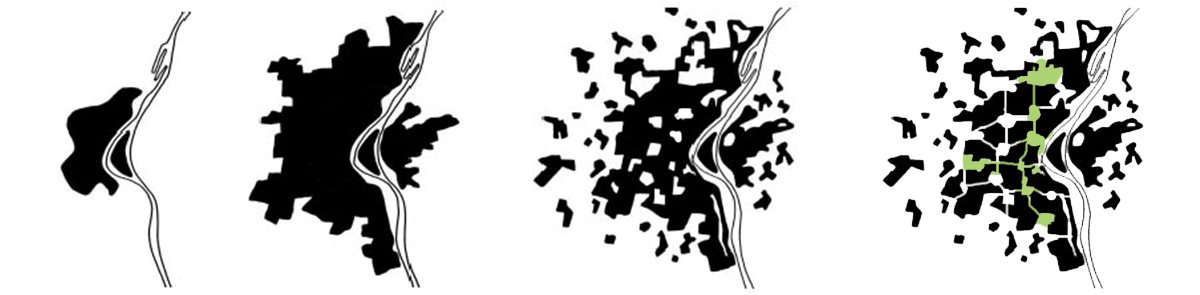
- Mapped a potential citywide green infrastructure network based on the ecological suitability of vacant parcels.
- Identified vacant parcels that may be suitable to serve as community gardens, parks, outdoor classrooms and trail connections.
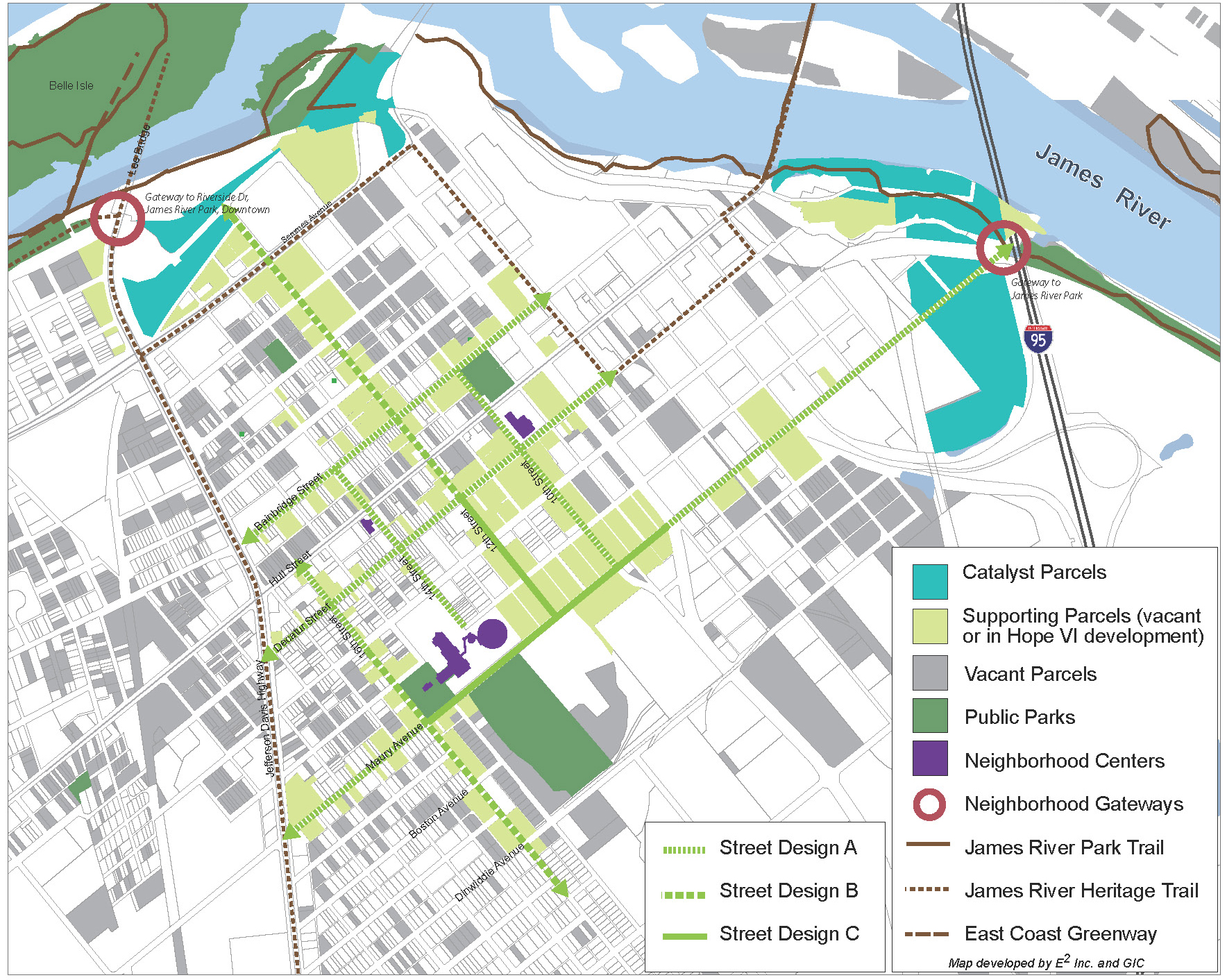
- Developed neighborhood concept plans that identify near-term opportunities for integrating green infrastructure amenities into the communities.
- Compiled a sustainable practices toolkit and case study library outlining best practices for implementation.
Outcome
As a result of this project, city staff and regional partners have a comprehensive framework for coordinating city greening efforts including tree planting, pedestrian improvements, development guidance and trail connections. The database provides an interactive tool for staff to easily identify vacant lands that have significant ecological or community value. The neighborhood concept plans provide a tool to coordinate and guide public and private investment in a way that increases green amenities for the local community. This landscape-based approach to revitalization provides a context for phasing improvements and programs, leveraging development opportunities, prioritizing acquisition, facilitating green-job creation and piloting green remediation strategies.